The Horse Dike
Most people are a bit puzzled when they read that Taylor and Pierson began their survey "at the End of the Horse Dike" in New Castle. Few have any idea what a horse dike is, much less where it was. It helps to know that in 1701 most of the settlers around New Castle were Dutch who had brought with them their marsh-reclaiming practices from the Netherlands. For centuries, people in the Low Countries had built dikes (mounds of earth) to hold back the sea, and without them, much of the Netherlands would have been underwater and uninhabitable.
The Dikes of New Castle
In 1664 the Duke of York conquered the Dutch colony of New Amsterdam which extended from present-day Delaware all the way to Nantucket. The Duke thereby gained control of the Delaware Bay and Valley that had been in Dutch and Swedish hands for over thirty years. The Dutch briefly recaptured New Amsterdam in late 1673 but returned it under the Treaty of Westminster six months later. In 1674 the Duke appointed Edmund Andros as his Deputy Governor.
In 1675 Andros commenced improving highways and bridges in the colony. There was a large marsh on the north side of the town of New Castle that was a good source of hay but was also an impediment to travelers heading north. The Governor ordered the Magistrates of New Castle to construct a Dike across this marsh to carry the King's Highway north and were given three months to do it. The dike was to be 10 feet wide at the base, five feet high, and three feet wide at the top (wide enough for a horse cart). Over the years, this dike has been known as the Town Dike, the Cart Dike, the Horse Dike, and the Broad Dike. Today it is known as Wilmington Rd. After the project was completed, the Town Dike was measured to be 1143 ft long, allowing 12 ft for the sluice.
The magistrates also ordered the repair of a privately-owned dike along the river, known as Mistress Block’s Dike, to protect the new dike. All the men in the district were ordered to appear and contribute two days’ labor on this project. These orders resulted in considerable discontent, especially with regards to being required to work on the privately-owned dike, but the work proceeded after two of the leaders of the resistance (one of whom was a Minister) were arrested. Mistress Block’s Dike has been known as the Narrow Dike, the Little Dike, the Foot Dike, and, much modernized, is still in use today.[1][2]
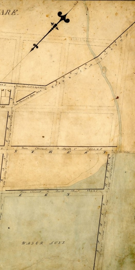
In 1805 Benjamin Latrobe drew a map of New Castle. At the northern end could be seen the "Broad Dyke" which carried the road to Wilmington. The "Little Dyke" extends off of the end of Second Street at the middle right of the detail map above. The triangle at the start of the Broad Dyke is today’s Veterans Memorial and is the site of the Broad Dyke Historical Marker.
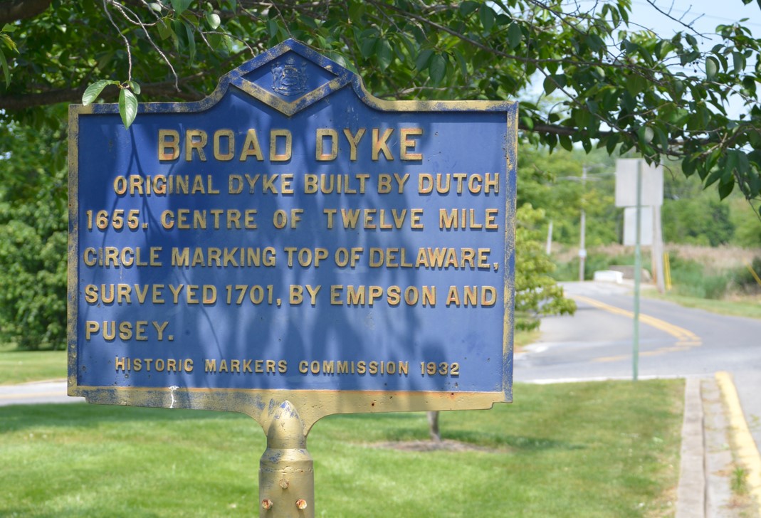
Broad Dyke Historical Marker looking North
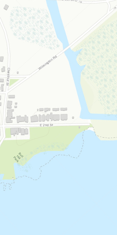
The Broad Dyke Historical Marker is on the west side of Wilmington Rd. Beyond it can be seen the intersection of 4th St and Wilmington Rd where Taylor and Pierson started their survey. About 400 ft in the distance can be seen the parapet of the bridge crossing the Broad Dyke Canal which runs through the center of the marsh.
References
| [1] | John Thomas Scharf, History of Delaware: 1609-1888, Vol. II (Philadelphia, PA: L. J. Richards & Co.,1888), pp. 860-861. ↩ |
| [2] | Jim Meek, “Dikes in New Castle”, 2012, https://nc-chap.org/dikes/. ↩ |