 |
Hodgkins 3 Mile Marker |
Location
GPS: 39.76143° N, 75.74988° W
National Historic Register Status
This Bounday Marker has been listed on the National Register by Delaware
1892 Hodgkins Boundary Survey
The current Delaware boundary line was drawn in 1892 by William C. Hodgkins of the United States Coast and Geodetic Survey. Hodgkins and his Commissioners had been charged with resurveying the boundary line drawn in 1701 by Isaac Taylor and Thomas Pierson, however for various reasons they instead contrived a new boundary line that was shifted towards New Castle anywhere from 300 to 700 feet in the New Garden area. Several Delaware residents were inexplicably less than pleased to learn that they now resided in Pennsylvania, and the uproar prevented the ratification of this new line until 1921.
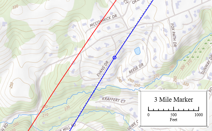
In this vicinity the new boundary (blue) was approximately 650 ft closer to New Castle than the 1701 line (red).
Unknown Date
Hodgkin's calculations placed this particular marker in the middle of a field. This would have been a constant nuisance to the farmer, so at some point the marker was removed and dumped in a nearby ravine.
USDA Aerial Photos, 1957/58 Series - Chester County, Roll: 12r, Photo #79 (Detail)
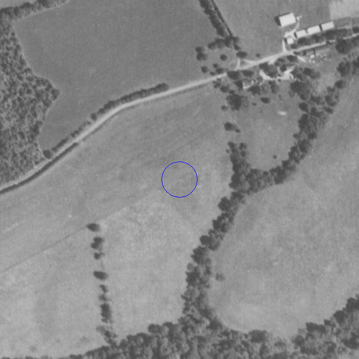
Approximate original location in the middle of the field.
1975 Listed on the National Register by Delaware
Delaware collectively placed all the Hodgkins boundary markers along with its Mason-Dixon markers on the National Register in 1975. The Nomination erroneously stated that the Hodgkins markers were 12 miles from the New Castle County Court House spire and, ignoring the 1892 inscriptions, that they were colonial.
1988 Boundary Marker Survey
In 1988, William Schenck of the Delaware Geological Survey undertook a survey to check the status of Delaware's boundary markers. He discovered that Hodgkins Marker #3 was missing. The area where the marker was supposed to be was being developed by Wilkinson Builders into a housing development. He asked Wilkinson to contact him if they discovered it during construction.
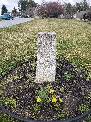
1991 Marker Reinstallation
In 1990, one of Wilkinson's workmen discovered the marker in the ravine. It was taken to the Delaware Geological Survey at the University of Delaware for storage. The following year it was reinstalled at the original location, now the front yard of a home on Evans Drive. The reinstalled monument was unveiled at a ceremony at which the main speaker was Delaware's Governor Mike Castle. Dignitaries included noted Delaware historian Dr. John Munroe.[1]
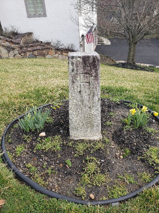
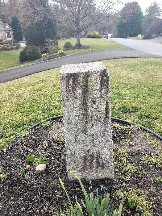
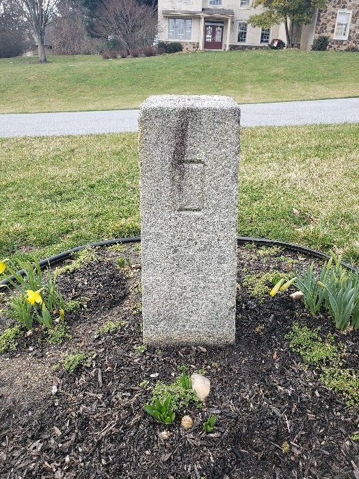
2024 Field Photos
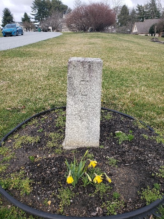
Inscription "3" (3 miles from Arc Corner)
Inscription "P" (Pennsylvania side)
Inscription "1892"
Inscription "D" (Delaware side)
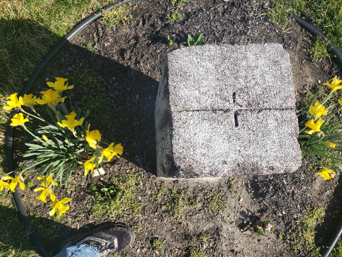
Top of marker inscribed with boundary line. Cross line marks coordinate.
References
| [1] | https://storymaps.arcgis.com/stories/920e34eb52dc41c5acf9b626af2d0c1b. You'll need to scroll down a little more than half way into this webpage to find the story about how it was found and restored as well as photos of the reinstallation ceremony. ↩ |